3 Waterfalls You MUST Visit in Hamilton, Ontario
In this video, we explore some of Hamilton's tallest waterfalls - Tew's Falls, Webster's Falls, and Albions Falls in stunning 4K.
Exploring 3 Hamilton Waterfalls
In early September 2024, we explored Tews’ Falls, Webster’s Falls, and Albion Falls in Hamilton, Ontario.
Within just 35 to 40 minutes of each other, we were able to visit all 3 of these places - some of Hamilton’s tallest waterfalls - in just two days!
Watch the full video of our hiking trip to Tew’s Falls, Webster’s Falls, and Albion Falls in Hamilton, Ontario!
Read our blog post below to learn about Webster’s Falls, Albion Falls, and Tew’s Falls.
We talk about the history behind each of the falls, how Hamilton got its nickname “The City of Waterfalls,” how many waterfalls Hamilton has, and so much more!
Don’t forget to dive into our video so you can enjoy more stunning views of these waterfalls.

History of Hamilton, Ontario
Getting to Hamilton’s waterfalls from Toronto
Hamilton, Ontario is a port city in the Canadian province of Ontario, roughly 45 kilometres southwest of Toronto (or just over an hour’s drive from Toronto, depending on traffic).
Due to its proximity to Toronto, Hamilton makes for a perfect day trip if you’re in the Greater Toronto Area – whether you live here or are just visiting!
How many waterfalls does Hamilton have?
Hamilton is nicknamed “The City of Waterfalls.” How many waterfalls does the community have? Over 100 of them! But it wasn’t always known for its natural beauty.
In 2000, however, a man by the name of Jerry Lawton made Hamiltonians aware that they were living in the ‘City of Waterfalls’ when he co-authored the picture book “Waterfalls, The Niagara Escarpment” with his son, photographer Mikal Lawton.
Around this time, He also made a presentation to the Hamilton Naturalist’s Club (HNC), urging the promotion of Hamilton as the ‘City of Waterfalls’.


How did Hamilton become the ‘City of Waterfalls?’
When this occurred, the city also inherited dozens more waterfalls.
Thus, by 2004, Joe Lawton had found 44 waterfalls and decided to approach the Hamilton Conservation Authority (HCA) with photos and information on them.
He met with Joan Bell and from there, Nadeem Paracha was contracted for one year to work with Bell on putting together a waterfalls group.
This group located 21 more waterfalls and over the next three years, was able to contract more workers, who helped to produce a list that included 96 waterfalls in Hamilton and 4 in neighbouring Burlington.
Explore Webster’s Falls, Tew’s Falls, and Albion Falls Hamilton in Our Video
As of today, this ‘Hamilton Waterfall Group’ has located 100 waterfalls in Hamilton, and we’re excited to share a few of the 3 tallest ones that you can visit today! Watch the full video of us exploring Tew’s Falls, Webster’s Falls, and Albion Falls here.
Tew’s Falls
HOW TO GET TO TEW’S FALLS
Tews Falls is located in the Spencer Gorge Conservation Area which is in the beautiful Hamilton neighbourhood of Dundas.
You’ll access the Tew’s Falls parking lot just off Harvest Road in Dundas.
COST OF ADMISSION FOR TEW’S FALLS
We entered the Tew’s Falls parking lot on a beautiful September morning. You can watch the full video of our travels here.
Since the area is managed by the Hamilton Conservation Authority, admission is $16 per car.
The prices go up during peak season, however (which is the Canadian Fall colour seasons, beginning September 28, 2024, and running to November-ish).

RESERVATIONS FOR TEW’S FALLS
During peak seasons, you’ll also need a reservation to visit these waterfalls, which you can pick up through the Hamilton Conservation Authority’s website. Luckily, we visited at about 9 am, and just a few weeks before the reservation requirements started, so we had no issues with it being overly busy.

HIKING AT TEW’S FALLS
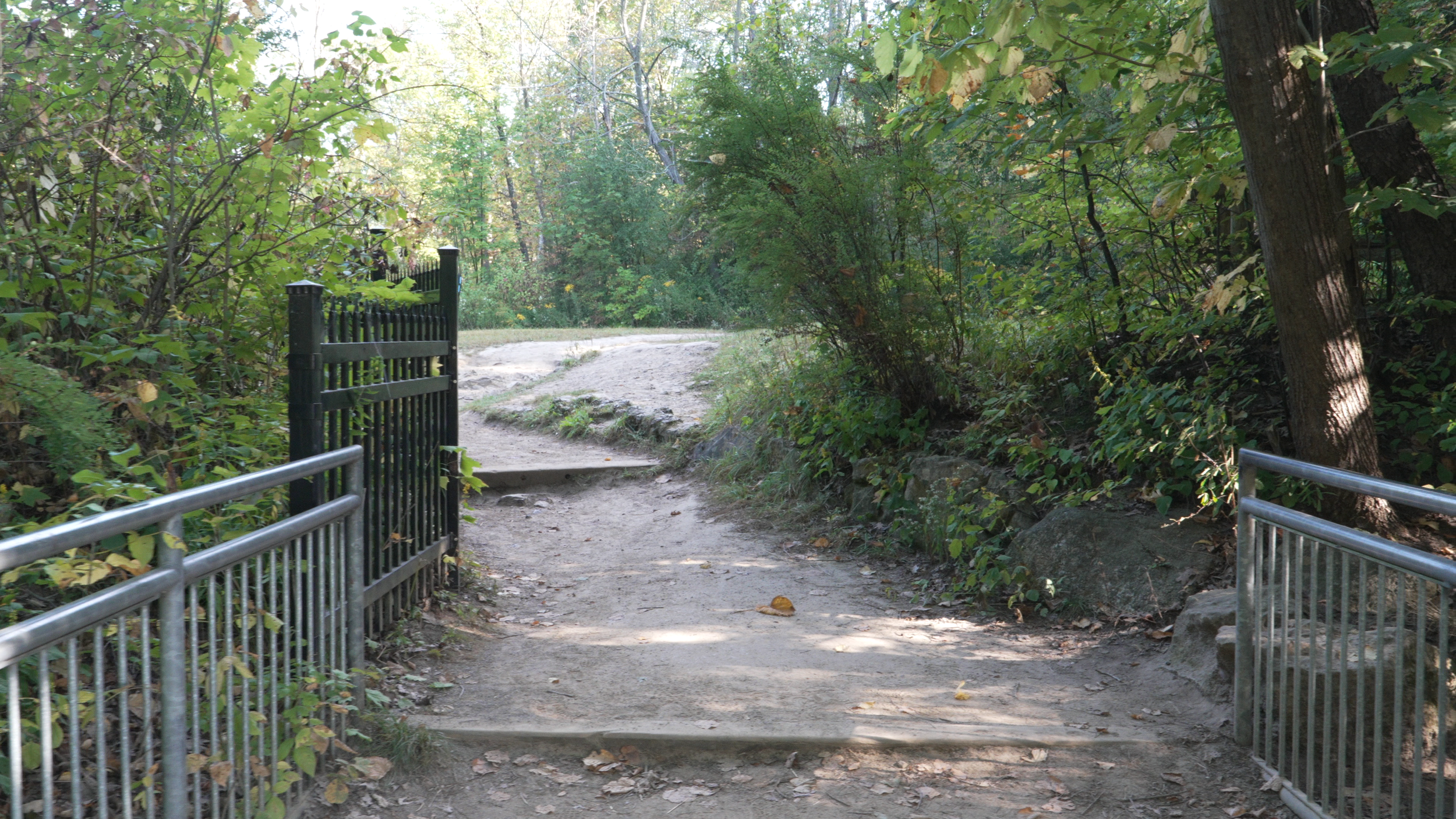
The hike to Tew’s Falls starts just past the parking gatehouse where you’ll cut right and head through the forest along a gravel path.
Once you cross the bridge to your right, you’ll see the Tew’s Falls sign (watch the full video of our travels here). and the first lookout point up ahead. This is barely 5 minutes into your hike!
At the first lookout, you’ll be able to see the full beauty of Tew’s Falls - the tallest waterfall in Hamilton, sitting at 41 metres (which is nearly the height of Niagara Falls)! Tews Falls is a “ribbon waterfall,” meaning water from the creek drops straight down into a deep gorge.

Tew's Falls is also a prime example of the unique geological formation that is the ‘Niagara Escarpment,’ which formed about 450 million years ago and is a massive ridge extending all the way from Niagara Falls, Ontario to Tobermory, Ontario.
It’s a long, steep slope of sedimentary rock, and the layers of rock that make up the escarpment have been worn away by the creek over thousands of years, resulting in the striking vertical drop of Tew’s Falls.
The ‘Niagara Escarpment’ is also “UNESCO World Biosphere Reserve” and has the oldest forest ecosystem and trees in eastern North America! Another fun fact is that the ‘Niagara Escarpment’ is actually the cliff over which the Niagara River plunges. This is famously known as ‘Niagara Falls.’
History of Tew’s Falls
There is not a ton of history on Tew’s Falls available, however, online sources state that they were originally known as ‘Hopkins Ravine,’ after the family that owned the property before the Tew’s.
Today, Tew’s Falls is named after Johnson Tew, who owned the property where the falls are from 1874 to 1947. In the early 19th century, much of the land surrounding the falls, including the “Dundas Peak Lookout” area, was farmland owned by the Tews and other early settlers.
GETTING TO DUNDAS PEAK FROM TEW’S FALLS
You can reach the Dundas Peak Lookout on the Tew’s Fall trail by continuing a bit further after reaching the Tew’s Falls lookout point. Dundas Peak offers stunning panoramic views of Hamilton and the Niagara Escarpment. Check out the incredible views seen at Dundas Peak in our video here.

Plus, it’s just a short distance from Tew’s Falls, so hiking up to the peak is a no-brainer considering the incredible scenery. There is also a huge viewing platform for Dundas Peak, so even if the place is busy, you’ll have no issues seeing the amazing scenery.
LENGTH OF HIKE, TERRAIN, AND WHAT TO BRING
The entire hike to Tew’s Falls and Dundas Peak will take roughly 40 minutes, depending on how long you stop to view the scenery and take photos. It can easily take over an hour, so plan lots of time in your trip so you don’t have to rush.
The hike is uphill at times and has uneven terrain (like tree roots sticking out) which means that you’ll want to wear comfortable shoes. You may also want to bring some snacks and water, although it’s important to note that you are NOT allowed to bring coolers into the conservation area.
The hike is uphill at times and has uneven terrain (like tree roots sticking out) which means that you’ll want to wear comfortable shoes.
You may also want to bring some snacks and water, although it’s important to note that you are NOT allowed to bring coolers into the conservation area.
I’ll also mention that since Tew’s Falls is managed by the Hamilton Conservation Authority, the area is only open from 8 am to sunset.
There is an automatic gate that will unlock if for some reason you are here past sunset, however, the hiking trails have cliffs and no lighting.
And with the trails being heavily covered by trees, it gets dark fast. So, it’s best to plan before you go so you have enough time to do the hike, enjoy the view, and make it back to your car before the sun sets.

Webster’s Falls
PARKING & HOW TO GET TO WEBSTER’S FALLS
“Webster’s Falls” is just around the corner from Tew’s Falls and takes roughly 3 mins to drive to.
You’ll access Webster’s off of Fallsview Road, which is not far from the Tew’s parking lot.
COST OF ADMISSION & RESERVATIONS AT WEBSTER’S
There is a $16 parking fee for Webster's Falls and reservations are required past September 28th.
HIKING AT WEBSTER’S FALLS
Starting from the Webster’s Falls parking lot, there is a small hiking area to the left of the parking lot where you can view the Webster Family Cemetery and do a loop along the escarpment which will lead you up to the first Falls lookout point.
This particular hiking trail has a lot of tree roots sticking out, so be careful. Not to mention there is a steep cliff on one side of the trail. Once you’ve finished the loop, you’ll see the parking lot again and the first falls lookout, which is behind a beautiful stone fence. Watch the full video here to get a glimpse of the beautiful iron fence atop of the lookout point at Webster’s Falls.
Webster's Falls sits at only 22 metres high and is a “curtain” waterfall, so the water flows smoothly over the edge in a wide sheet.

History of Webster’s Falls
Online sources state that Webster’s Falls was originally known as “Dr. Hamilton’s” falls after Dr. James Hamilton purchased the land in 1818. The land was purchased by Joseph Webster in 1820.
He expanded operations and further developed the property. In 1856, Webster’s son built a large stone flour mill, the Ashbourne Mills, along the creek above the falls.
George Harper and W.S. Merrill took over the mill in 1891 and expanded operations.
In 1898, a fire destroyed the buildings, so Harper turned to the idea of generating electricity, building one of Ontario’s first electrical generating plants at the base of the falls.
WEBSTER’S FALLS STONE BRIDGE
If you head down the trail just past the parking lot and waterfall platform, you’ll find a paved walkway to the left that leads you to the other side of the gorge.
From there, you can see another view of the falls and get a closer look at the water flowing over the cliff.
You’ll also get to see multiple close-up angles of the beautiful stone bridge. Watch the full video of our travels here to see more angles of the iconic cobblestone bridge at Webster’s Falls Conservation Area.

The hike around Webster’s Falls Conservation Area will also take roughly an hour and a half, give or take, so you’ll want to wear comfortable shoes for this one, too.
SPENCER CREEK AT WEBSTER’S FALLS
Just past the first cobblestone bridge is another smaller stone bridge and a beautiful spot to view Spencer Creek, which feeds the falls.
Webster’s Falls helped spur economic development in early Hamilton.
Mills like the one previously located at Webster’s Falls were essential for grinding grain into flour for the growing community of Hamilton in the early 19th century.
Spencer Creek rushes over a small cascade just a few metres up from the second cobblestone bridge found at Webster's Falls Conservation Area
At the time, Spencer Creek and its waterfalls were at the heart of local industry, with several mills dotting the creek, all taking advantage of the water’s energy to drive the machinery needed for flour production.
In 1917, the Public Utilities Commission of Dundas bought Webster’s Falls and the surrounding lands for the town’s waterworks department. In 1933, when the will of former Dundas Mayor Colonel W.E.S. Knowles was read, it was learned that Knowles had requested that the town turn the area around Webster’s Falls into a public park.
Thus, a foundation was established to channel revenue into park improvements, the grounds of Webster’s Falls Conservation Area were landscaped, a stone bridge was constructed across the creek above the falls, and an iron fence was installed to make the viewing at the ledge of the falls much safer.
Over time, the stone bridge has been repaired and still stands to this day – a well-loved feature of the area. The falls are now part of the Webster’s Falls Conservation Area and are by far one of Hamilton’s most popular and picturesque waterfalls. Watch the full video of our travels here to see more of the incredible scenery at Webster’s Fall’s Conservation Area.
LOVE & TRAGEDY AT WEBSTER’S FALLS
And like many of Hamilton’s waterfalls, there are also stories of love and tragedy intertwined within the rich history of the falls. One story listed on the Hamilton Conservation Authority’s website is of a princess and her lover before Europeans arrived in the area.
The princess, promised in marriage to a young chief of the Erie Nation, had fallen in love with a high-ranking man from the Seneca Nation. The princess’s father threatened to imprison her unless she agreed to marry the Erie nation chief.
Thus, the story goes that the young lovers locked themselves in each other’s arms and jumped over the edge of the falls, ultimately deciding that life without each other was not worth living.
The legend also states that when the water level is high, the air is filled with a silvery mist from the full moon. It’s then that the princess and her lover can be seen rising to the edge of the falls, where they once again pledge their endless love.
Albion Falls
PARKING & HOW TO GET TO ALBION FALLS
Albion Falls is managed by the city, so there is free parking at Upper King’s Forest Park on Mountain Brow Blvd.
It’s about a 35 to 40-minute drive from Webster’s Falls, but it’s free to access and its viewing platforms are open to the public 24/7.
HIKING AT ALBION FALLS
Albion Falls can be easily viewed just a few metres from the parking lot.

There are 2 platforms for viewing - a small one providing a side view of the falls and another multi-level platform that provides a head-on view. *Note that the falls are quite far from the platform so you need a good zoom lens to get high-quality photos of the falls.
Albion Falls sits at 19 metres high and is one of the most popular waterfalls on the east side of Hamilton and the viewing platforms can get quite busy on the weekends. It’s a “cascade” waterfall meaning the water tumbles over a series of steps, creating a cool layered effect. Watch the full video here and see Albion Falls in all its glory.

History of Albion Falls
In 1792, a grist mill was built by a man named William Davis near Albion Falls.
It was used to grind the grains that the local farmers would bring and served the centre of the small village of Mount Albion.
Albion Mills is where the falls take their name from and was vital to the early settlers of the area, serving the community’s agricultural needs.
The power provided by Red Hill Creek and Albion Falls supported the village’s economy, making way for businesses like blacksmith shops, inns, and even a general store.
Watch the full video here to experience the magnificent power of Albion Falls.
Unfortunately, like many early industrial settlements, Albion Village faded away with time as newer technologies and changes in industrial needs emerged, leaving behind the legacy of the falls.
Albion Falls was even once considered as a possible water supply source for Hamilton, due to its reliable flow of water, but the project eventually chose a different location. Additionally, the rocks from the surrounding area at the falls were used in the rock garden of the Royal Botanical Gardens in Burlington, Ontario.
THE TRAGIC TALE OF JANE RILEY AT ALBION FALLS
Albion Falls is also known for its part in local folklore, with several stories of love and tragedy tied to its steep cliffs. One particularly well-known tale is about a young woman named Jane Riley.
According to online sources, Jane was a captivating girl who had fallen in love with a local man named Joseph Rousseau. Joseph’s mother disapproved of their relationship, however, as she didn’t like the fact that Jane was “poor” and of a lower class.
Thus, Joseph stopped calling on Jane and sources stated that Jane would disappear for days in the woods only to reappear wailing and troubled. Finally, deciding that she didn’t want to live without her one true love, Jane threw herself headlong over the edge of Albion Falls.
Unfortunately, some men who were working in the ravine below saw Jane Riley fall. They said that she “went down like a shot” upon the rough and broken rocks below. When the men found her, she was still alive. Her body was mangled, and she was unconscious, surviving for just an hour after her initial fall.
Sources also state that Joseph’s mother was said to have felt guilty about the fact that she led her son to be so cruel to poor Jane. Apparently, Joseph Rousseau’s mother was quoted saying “Let the blame rest on my shoulders.”
They even say that on moonlit nights, if you listen quietly, you can hear the wind carrying the cries of Jane Riley. This tragic story is also why the falls have been nicknamed ‘Lover’s Leap.’
At Albion Falls, there are also a few trails that run along the edge of the Niagara Escarpment and can be accessed just past the viewing platforms. Watch the full video here to see the hiking trails at Albion Falls.

BEWARE OF POISON IVY AT ALBION FALLS
You must be careful on these trails. There is lots of poison ivy, there are tree roots sticking out, steep cliffs, and even bicyclists zipping down the path.
Due to the uneven terrain, you could easily trip and fall and hurt yourself severely, so wear proper footwear when hiking these trails.
No Access to the Base of Falls
While you used to be able to access the base of Albion and Webster’s Falls, however, fencing and safety measures have been added due to the steep terrain and many accidents that have occurred at these places.
As of 2017, there had been at least eight emergency responses (to all of Hamilton's waterfalls) including the death of a young Toronto man after slipping at Albion Falls. Not to mention, most of these waterfalls are extremely ecologically sensitive areas.
Thus, with the falls being fenced off and protected from foot traffic, they have the chance to regain their strength so we can enjoy their natural wonder and beauty for even longer.
There are massive fines for trespassing, so I don’t suggest it. Instead, enjoy the beauty from the safety of the platforms that have been built for us. You can watch the full video here to get a glimpse of what the viewing platforms at Albion Falls are like.

The Indigenous History Behind Hamilton’s Waterfalls
And when it comes to these beautiful places, we must remember that it’s not just European history that lives here, there is a rich Indigenous connection to Hamilton's waterfalls that was present long before European settlers ever arrived.
The land of which the city sits is covered by the ‘Dish with One Spoon Wampum Belt Covenant,’ an agreement between the Haudenosaunee and Anishinaabek to share and care for the resources around the Great Lakes.
This also means that indigenous nations lived around the Niagara Escarpment, including areas near Tew’s Falls, Webster’s Falls, and Albion Falls LONG before Europeans did.
This also means that these waterfalls weren’t just farms, mills, or beautiful landmarks—they were central to Indigenous life as part of trade routes, hunting grounds, and spiritual sites.

The surrounding creeks, like Spencer Creek, for example, provided fresh water, fish, and fertile land, essential to Indigenous life.
Many major roads in southern Ontario are built upon ancient paths created by indigenous peoples.
These pathways connected the indigenous settlements to hunting grounds, trading posts, and forts.
As you travel around these waterfalls, think of the ones who first walked these paths. While much has changed with the arrival of European settlers, the Indigenous connection to these natural sites remains important.
Learning about indigenous history is vital for respecting the land and cultures that have long cared for it. By acknowledging the original caretakers of the land and taking time to preserve and understand their history, we can help to promote a more responsible relationship with the land for future generations.
Watch Our Video to See the Full Natural Beauty
We visited Tews Falls, Webster’s Falls, and Albion Falls. We also learned about the Indigenous and European history behind these gorgeous destinations.
You can watch the full video here to see all the places we discussed in this blog post.
We discovered how to find these unique spots, where to park, how much they cost to visit, and what the hike/terrain is like.
We even talked about when these spots get busy, and what to bring with you on the adventure, so now you’re ready to get out and explore 3 of Hamilton, Ontario’s tallest waterfalls.
Well… what are you waiting for, then? Get out there and start exploring!
Tew's Falls tumbles over a steep cliff and into the gorge below.
Find more exciting blog posts, videos, and other content about Hamilton, Ontario at WWW.360HAMILTON.CA